Explore the Past with Google Earth Timelapse
Have you ever wanted to explore the changes of our world over the years? To understand how topography developed or where urban expansion has taken place? With Google Earth Timelapse, you can take a journey back in time from 1984 to 2021 and make sense of it all.
In this beginner’s guide, we’ll look at how to access and use Google Earth Pro, Maps, and Timelapse so you can get the most out of them. From understanding how to easily identify places of interest and track changes to creating sharable content for your work or interests, this guide will provide an introduction to exploring our past with Google Earth swiss-knife tools.
What is Google Earth Timelapse?
Google Earth Timelapse is a revolutionary project that has been stitching together satellite photos for four decades. It’s an interactive time-lapse map, allowing users to explore the evolution of any location by viewing a 3D representation of Earth based mostly on satellite imagery. Google is collaborating with several organizations on its Timelapse project, including NASA, the US Geological Survey’s Landsat program, the European Union’s Copernicus program and Carnegie Mellon University’s CREATE Lab.
When you open Timelapse in Google Earth, you can scroll through the past and watch how a location has changed over the years – from searching for a specific spot to zooming in and out of the map to view images of our planet in different ways. Plus, downloading Google Earth. Pro gives access to extra tools such as exporting still images and videos or creating custom timelapses!
The Google Earth Timelapse also helps gain an understanding of changes that have occurred over recent decades – then share your findings with others via the handy Google Alerts feature. And surveys are available too so you can learn more about your audience and make your timelapse experience even more enjoyable!
How Can I Access Google Earth Timelapse?

Google Earth Timelapse is a revolutionary tool that takes viewers on a journey through time. With just the click of a button, you can explore past imagery and uncover hidden secrets about our planet’s changing landscape. To access this feature, simply open up Google Earth or Google Earth Pro and use the search bar to locate your desired location. Then scroll through the timeline to view street view images from different points in time – it’s as easy as pie!
The Featured Locations section on the homepage of Google Earth Pro includes topics such as deforestation, mining, natural disasters and infrastructure – all ready for exploration. You can pan and zoom around like with regular Google Maps too! If you’re looking for something other than what’s featured on the homepage, just type it into the search bar and away you go!
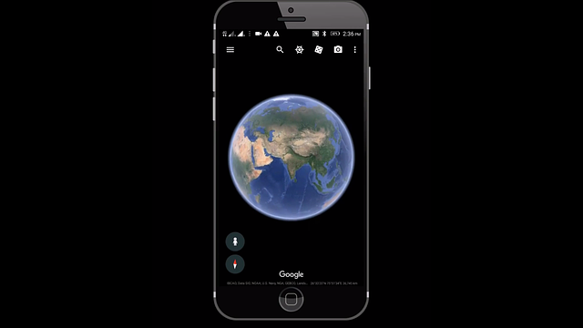
Google Earth Timelapse is available both online and via mobile app; so no matter where you are in the world, you can take advantage of its features. On web browsers, watch global timelapse videos or download Google Earth Pro to create custom ones; while on mobile devices tap Time icon in upper right corner to access historical imagery animations.
Overall, using Google Earth Timelapse offers an incredible opportunity to gain insight into our ever-changing planet – whether it be for educational purposes or recreational enjoyment! So why not give it a try?
View Streets of the Past on Google Maps
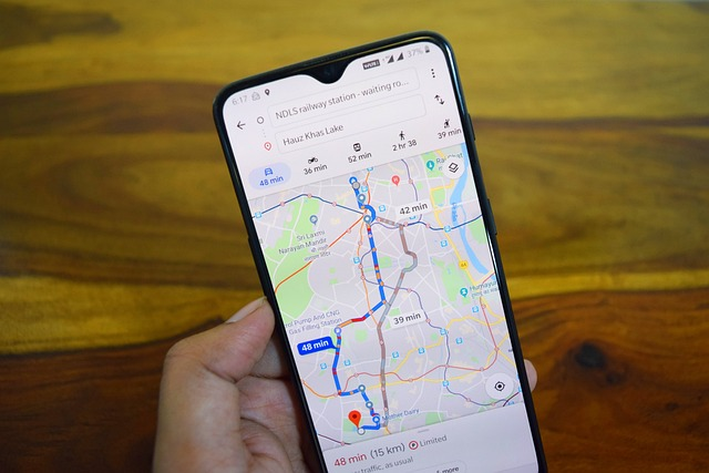
Google Maps is a time machine, allowing you to explore the past. To access Street View, simply navigate to your desired location and look for the blue lines on the map – these indicate where Street View is available. Grab Pegman and drag him onto one of those lines to view street imagery from that spot.
The time slider is an incredible feature which allows you to travel through history! On both Google Earth app and desktop version, it’s located in the left sidebar with a clock icon next to it. The slider displays notches for each piece of imagery available at this view – move it all the way right for fresher images or left for older ones. Each image is labelled with day, month and year so you can easily find what you’re looking for! You can also use this tool to change the time of day and see different panoramas.
Change the Time of Day
The time slider in Google Maps is like a time machine. To access it, simply navigate to the location you want to explore and look for the blue lines on the map – these indicate where Street View is available. Grab the Pegman and drag him to one of those blue lines to view the street view imagery of that location.
Once you’re in Street View, use the time slider with its clock icon on the left sidebar. It displays a notch for every piece of imagery available at this spot – move it all the way right to explore different times of day or slide it leftwards for past images. Each image is labelled with date, month and year within the slider itself – so just click and drag it to your desired time!
Explore Historical Imagery
Google Maps provides a unique opportunity to take a trip down memory lane. But how do you access this feature? Simply navigate to the location you want to explore and look for the blue lines on the map – these indicate where Street View is available. Grab the Pegman and drag him onto one of those blue lines, and voila! You can now explore historical imagery with the time slider.
On the left sidebar, there’s a clock icon next to it – move that all the way right to see different times of day or slide it leftwards for images from days gone by. Each image is labelled with its date so you can easily toggle between panoramas just by clicking and dragging on that timeline. It’s like flipping through pages in an old photo album!
And if you’re looking for even more detail, why not try Timelapse in Google Earth?
Moving Through Time with Google Earth Pro

Google Earth Pro is an advanced version of the popular Google Earth app, boasting extra features and capabilities. One of these is the time slider – a tool to explore past landscapes by simply moving through time. To use it, open up Google Earth Pro, click on the clock icon in the top menu and move the time slider at the bottom of your screen to change date and view corresponding imagery.
Once you’ve selected your desired location and date, hit “Save Image” to save it as a file. Enter a name for it in the dialogue box then click’save’. How easy was that?
Exporting Still Images and Video
Using the time slider feature in Google Earth Pro, you can take a journey through time. Simply move the time slider to your desired location and date, click ‘Save Image’, name the file and voila! You have an image of that moment frozen in time.
But wait – there’s more! Select ‘More Options’ then ‘Export Video’ for a timelapse video of your chosen location. Here you can set start and end times, adjust speed and save it all with just one click.
Creating a Custom Timelapse
Creating a custom timelapse on Google Earth Pro is a great way to explore the past. To get started, open up Google Earth Pro and click the clock icon in the top menu. Use the time slider to select your desired location and date. Then, hit ‘more options’ for access to timeline feature. This will bring up a window with current location and date information. To add a keyframe, simply click the plus icon and move time slider to desired spot. Adjust loop and duration info for each keyframe by clicking it in the transition panel then adjusting settings as needed. Finally, when you’re done creating your timeline, save video or image by clicking ‘Save Video’ or ‘Save Image’ respectively!
Google Earth Engine: Landsat Timelapse

Google Earth Engine and Landsat Timelapse are two remarkable tools that can take us back in time. The Landsat satellite program has been capturing images of the Earth’s surface since the 1970s, making it one of the longest-running Earth observation programs ever. With Landsat Timelapse, users can compare satellite images from different eras, observe deforestation over time, and witness how urbanization and climate change have impacted our landscape.
In addition to imagery, this tool also provides access to geospatial datasets such as elevation data, temperature data, and population density – giving us a better understanding of land features and interactions between land use, population growth, and climate. Google Earth. Pro also offers historical maps like USGS aerial photography or topographic maps which allow for an even deeper exploration into the past.
By combining these powerful tools together we gain an unprecedented view of changes that have taken place over years – allowing us to understand how our planet has evolved through time.
Sharing a Timelapse

Sharing a timelapse just got easier with Google Earth Pro, Maps and Timelapse. All you have to do is click the Share button in the upper right corner of your map and voila! You’ll get a link and an embed code that will take viewers straight to the same area of your map.
But wait, there’s more! If you want even more options for your link, head over to the ‘Directions’ tab on their website. Here you can find specific instructions for using it plus a ‘Timelapse’ button so everyone can experience what you’re seeing too.
Google Earth Pro, Maps and Timelapse make sharing timelapses effortless – from generating links and codes to exploring historical imagery together – this feature has it all!
Google Alerts: Stay in the Know
Google Alerts is like a personal assistant that keeps you in the loop about topics that matter to you. Setting up your own Google Alerts takes just five minutes – no sweat! You can get notifications when news is published, videos are posted on YouTube, or someone tweets something interesting. Plus, if you want to keep an eye on your own content (like blog posts and website pages), Google Alerts has got your back.
Customize how you receive alerts with ease: via email or computer, or even directly through Twitter! With its simple setup process and customizable notifications, Google Alerts is an invaluable tool for anyone who wants to stay informed about their interests – whether they’re a beginner or a pro.
Learn More About Your Audience with Surveys
Surveys are a powerful tool, like a magnifying glass for your audience. In just five minutes you can gain valuable insight into their demographics, preferences and behaviors – even what they are likely to do in the future. This data is invaluable when it comes to creating content that resonates with them and effectively reaches your goals.
Surveys provide an efficient way to identify trends and patterns within your audience, helping you understand their motivations and desires. By taking the time to get to know them through surveys, you can create content that engages them on a deeper level – allowing you to reach new heights of success!
Summary
Google Earth Timelapse offers an interactive, user-friendly platform to explore the past and gain insights into the world around us. From accessing past street views on Google Maps and adjusting the time of day to exporting still images and videos, this tool empowers users to explore the past and build their own custom timelapses.
Landsat Timelapse allows users to explore a wide variety of historical maps and imagery, while Google Alerts keep users up-to-date on topics of interest. Additionally, surveys provide an efficient way to learn more about an audience and inform content tailored to preferences.
Ultimately, Google Earth Pro, Maps and Timelapse offer an exhilarating opportunity for discovering the history around us and exploring unseen locations as though we’re literally traveling through time.
Frequently Asked Questions
How do you do a timelapse on google earth?
Creating a satellite timelapse on Google Earth is simple and straightforward. Draw a Region of Interest (ROI) on the map, upload a GeoJSON file to the web app, select a suitable satellite image collection, and customize your timelapse parameters.
Access your timelapse in GIF and MP4 formats to experience a 37-year visualization of any town!
How do i see past years on google earth?
Using Google Earth, you can view past images of your desired location by clicking “View” in the menu bar and selecting “Historical Imagery”. Then use the time-lapse bar at the top of your 3D viewer to scroll through images available since 2001.
Can you change years on google earth?
Yes, you can change the years on Google Earth. You can access the Historical Imagery option by clicking View or the clock icon above the 3D view option. Select the desired time period to view the images that are available for that particular time.
Is google earth timelapse on mobile?
Yes, Google Earth timelapse is available on mobile, as it can be accessed through the Google Earth app for Android.
How do i use google timelapse?
Using Google Timelapse is easy. First, open up your browser and navigate to g.co/timelapse. Then use the “Search the planet” search bar to select any location on the planet you want to explore.
Once you pick a place, watch as the timelapse begins and explore the world around you!