Exploring the Fascinating History of Mapping the World
The way in which humans explore, represent and interact with the world around them has changed dramatically over the years. From ancient canvas maps to modern digital versions, the concept of mapping the world has developed through technologies only dreamed of by past generations.
In this article, we will be exploring the fascinating history of mapping the world and looking at the major technological landmarks that shape today’s maps. We’ll cover different eras and purposes of mapping, from navigational charts to scientific instruments and more.
By delving into mankind’s varied methods of understanding their environment, readers will gain a greater appreciation of the development of cartography and the interconnectedness of our world.
Ancient Maps
The craft of cartography, or mapmaking, has been around since ancient times. From simple drawings on rocks to the incredibly detailed digital maps of today – it’s a journey that spans centuries.
In those early times, countries were mapped by hand with great accuracy. Ancient mapmakers would draw mountain ranges and seas onto flat surfaces using projections – lines indicating distance between two points and boundaries showing where one country ended and another began. Sometimes north was at the top and south at the bottom!
The earliest known maps date back to Babylonians, Egyptians and Chinese – usually drawn on clay tablets in schematic style. These maps often included major cities, rivers and mountain ranges, as well as other geographical features – personifying our planet for generations to come!
Early Cartography
Throughout the centuries, cartography has been a journey of discovery. In the Middle Ages, Islamic cartography was like a compass guiding us to map the world. Maps of this era featured more accurate depictions of the world, such as lines of latitude and longitude, plus picturesque images of mountains, rivers and other geographic features.
The 16th century marked an incredible milestone in cartography – national geographic maps were created using Mercator projection which allowed for precise portrayals on flat maps. Mapmakers could measure distances between two points with accuracy and these maps included cities, seas and mountain ranges in intricate detail. Cartography is truly an art form that continues to shape our understanding of the world around us.
Greek and Roman Maps
The Greeks and Romans revolutionized cartography, crafting a map of the world that was shaped like a globe and featured mountains, seas, rivers and more. They used lines to measure distances between two points and boundaries to separate countries. But they didn’t stop there – their maps also included language and cultural information so they could better understand the people living in each region.
The Greeks and Romans even invented thematic maps which show geographic features in relation to themes such as population density or climate. These maps were used to study locations around the world, helping them gain insight into their surroundings.
Medieval Maps

Maps have been mankind’s faithful companions for centuries, helping us to explore and comprehend the world around us. During the Medieval period, these guides transformed from crude sketches into intricate depictions of our planet. Islamic cartography had a major impact on this evolution, acting as a catalyst that propelled European maps to new heights. Moreover, borders have been in constant flux throughout history – an ever-shifting edge of our world.
Islamic Cartography
Islamic cartographers were trailblazers in the world of cartography, revolutionizing European maps with their innovative form. They used a combination of mathematical geometry, astronomy and geography to craft intricate maps of the world. Curved lines were employed to represent both North and South poles while dividing it into two hemispheres. These techniques enabled them to accurately depict Middle East, North Asia and South Asia’s geographic features.
Thematic maps were also created by Islamic cartographers which focused on topics such as population, trade routes and religious sites – all highly detailed providing an abundance of information about the world.
European Maps
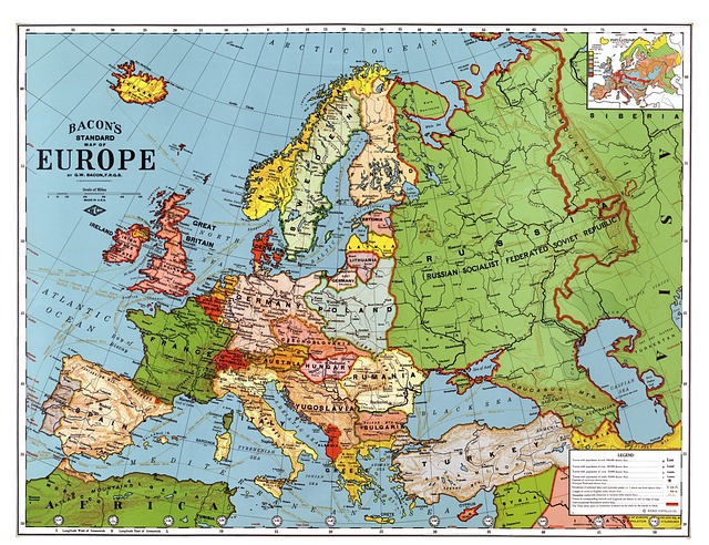
European maps were like sponges, soaking up the influence of Islamic cartography. The Mercator projection was developed by a European cartographer inspired by Islamic techniques and used to create large-scale world maps, giving Europeans an expansive view of the planet. These detailed maps allowed them to draw precise borders and accurately depict national boundaries – better than their Islamic counterparts. Additionally, they included descriptions of bays, gulfs, and seas that were absent from Islamic maps; these features painted a fuller picture for Europeans.
Digital Mapping
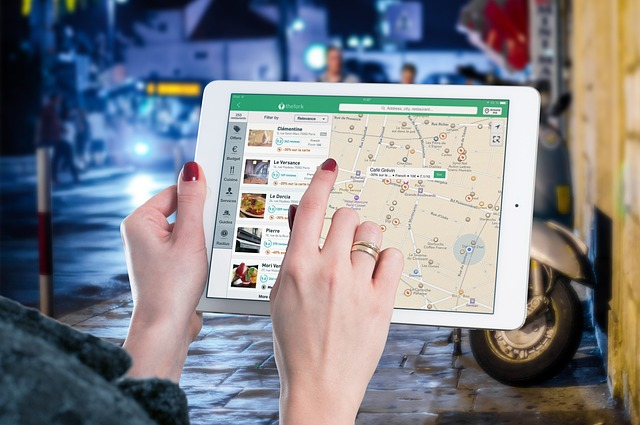
Digital mapping is like a modern-day GPS, using computers and other digital technologies to create detailed maps of the world. The most famous example is the Mercator projection from 1569 – a flat map that shows countries’ relative size and shape, as well as lines of latitude and longitude for easy location. But how has digital mapping changed our lives? It’s revolutionized the way we make, view, and use maps – creating detailed images of geographic features plus thematic maps focusing on specific topics or themes.
Satellite Imaging
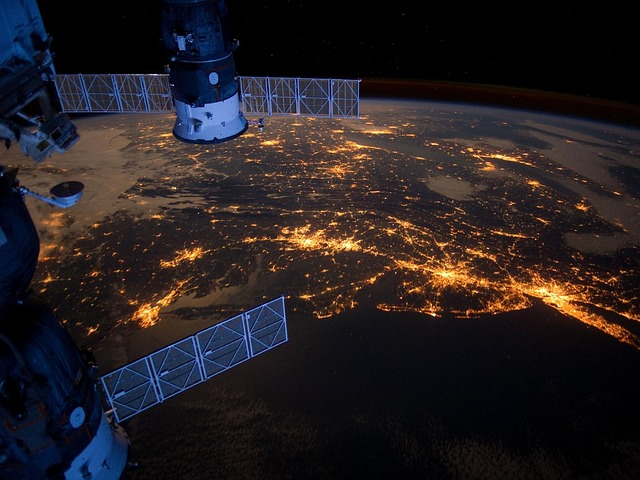
Satellite imaging is like a bird’s eye view of the world, capturing images from space to create an accurate map. The process begins with acquiring the satellite images and removing any atmospheric distortion. Then, these pictures are aligned and merged into one image before being processed to form a map. This map shows continents, oceans, countries and their borders, as well as meridians and parallels – all presented in a flat projection such as the Mercator projection which is most commonly used for national geographic maps.
GIS Mapping
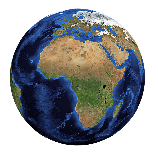
GIS mapping is like a digital mapmaker, creating detailed and accurate maps of the world using computer technology instead of satellite images. The process involves collecting data, analyzing it to identify geographic features and locations, then presenting it in a flat projection such as the Mercator projection.
GIS mapping has many uses – from providing food for hundreds of species of fish and wild game animals to giving people jobs or being used for fresh water irrigation and power generation. It’s even over 4,000 miles long and covers nine countries!
But most importantly, GIS mapping has revolutionized how we create, view, and use maps. By making use of computers and other digital technologies, it’s become much easier to make detailed maps that are both informative and visually appealing.
Summary
Over the centuries, mapmaking has been a critical activity for understanding and documenting our world. From simple drawings on rocks to intricate digital maps, thorough mapmaking has allowed us to explore diverse geographic locations and features with varying levels of accuracy. Early cartography evolved from basic geographical drawings developed by the Greeks and Romans to include thematic elements in the Middle Ages that better illustrated different regions.
Islamic cartographers adapted knowledge of geometry, astronomy, and geography to create accurate representations of the Middle East, North Asia, and South Asia. Later, European maps heavily relied on this new knowledge to give detailed and descriptive accounts of bays, gulfs, and seas as well as grasp a better comprehension of the world.
Today, advances in satellite imagery and GIS technologies provide us with highly precise visualizations of our planet and its geographic features. Mapmaking is an inexhaustible endeavor, and each new level of effectiveness opens the pathway for greater exploration and inquiry into our world.